maps

You are currently browsing the archive for the maps category.

early morning in the desertWell. Last Thursday, things did not go as planned

Well, unless the plan was to spend 3 hours in the desert trying to reach my source and hoping he was just running late (he wasn’t), things did not go as planned.

The appointment had been to find out about an active search for a 21-year-old man who disappeared approximately 7 weeks ago. I’d spoken to the man leading that day’s trip and tracked down the phone number of the missing man’s father, who’d come to Tucson from Tennessee in hopes of finding answers, the original tip coming from a mass email:

“Could you please run on the [humanitarian organization] site a notice that there is a father here from [a southern state] who has been looking for his 21 yo son left by his group 5 weeks ago and please call and take him out if people have time?…He has been here in Tucson for five weeks, living on the street and searching daily…He’s been sent a map of where to look but it’s a very bad map from the person who was with his son and was apprehended and deported. The map maker would like to be paid for a better map……..BTW, he’s already checked the morgue (negative) and I will check hospitals today.”

Then a week later, a notice that more help with the search was coming from San Diego “for his 21 year old son…who was left behind in the desert, ‘en mala condicion’ on April 18.”

My goal was to hike out with the searchers and find out how their location and recovery work is different from that of the volunteers who provide humanitarian aid through water drops and rescue patrol. It would be a bonus if I could also find out more about the stories of the missing man and his father – especially how he traced someone in the group to get a map.

But planning ahead was no match for crossed wires and cell signal issues – one phone went straight to voicemail, the other to a recording that the user could not get calls or take messages. (I’m still trying to get through on one line or the other, and am optimistic I’ll reach the expert from San Diego as we’d played telephone tag before a few years ago while I was finishing my original story for News21 – yet I regret to say that my hopes of reaching the father are rapidly diminishing.)

Border Patrol vehicles get gas at Three Point, Arizona's Robles JunctionI was half an hour early for our 6am appointment. By 8am I’d counted over 30 Border Patrol vehicles alone – and I was realizing I would probably need to go back to my original posting plans. The break in the usual programming was not going to be necessary after all. A few phone calls and mobile google mappings and I pulled out of the parking lot half an hour later resigned to the 2.5 hour solo drive home, all if which with my tail between my legs and hoping no one would notice I was back more than a little early.

About a mile east I pulled over and looked at the map again. With my north Phoenix apartment as the starting point, I was over 75% of the way to Sasabe if I continued south on the 286 between BANWR and the Tohono O’odham Nation. And from there I could drive eastwards on the twisty Arrivaca Road to pick up the I19 which connects Nogales back to Phoenix through Tucson. And I already had the day off…

flowering tree on Hwy 286 between Three Points and SasabeI decided to go exploring.

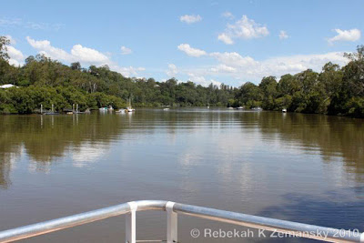
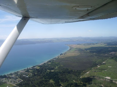
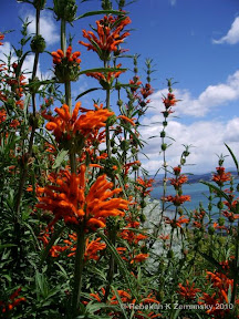
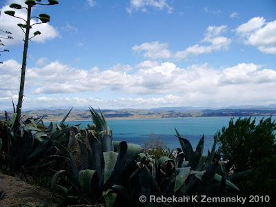
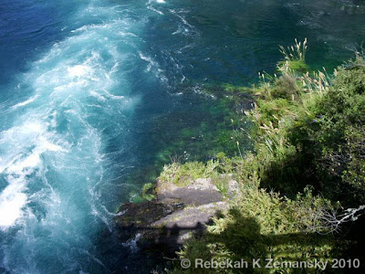
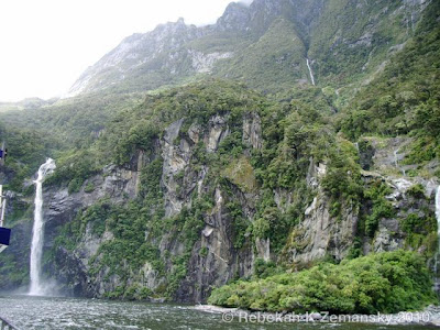
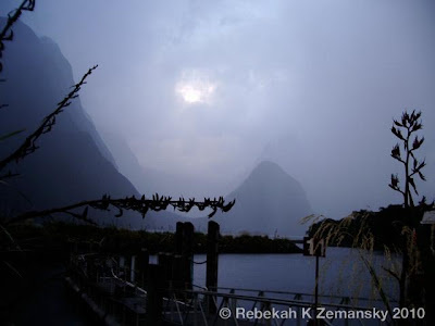
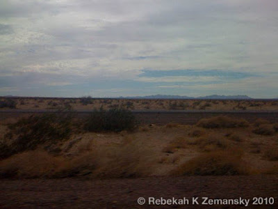
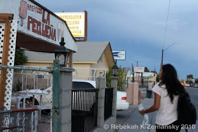
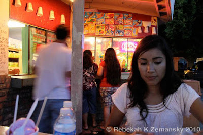
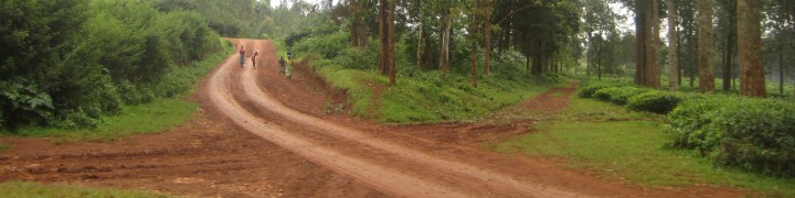
I’d come this way twice before, in winter and midsummer, and now the land was lusher and filled with the colors of thick bushes to slowly bleaching grasses. Diamond warning signs for floods and fire gave hints at the volatility of the valley landscape that rolled along either side of the highway beneath the eyes of parallel mountain ranges while border patrol checkpoints and white private security buses hinted at other kinds of volatility.

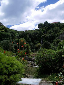
With no goals or appointments I was free to move slowly and notice details along the nearly empty like fully flowering trees or ringed roadside shrines.

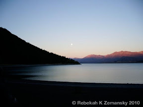
I took the trip in pieces, regaining the familiar lines of the metro Phoenix skyline as the heavy summer sun begins to slide onto the horizon. Back in my apartment for the night with my shoes by the front door I checked the day’s mileage for this trip to and along a sliver of the U.S.-Mexico border between Arizona and Sonora and it clocked in at just over 460 miles.

view of Baboquivari Peak from Hwy 286 between Three Points and Sasabe between Sasabe and Nogales on Arivaca Road between Sasabe and Nogales on Arivaca Road


View Larger Map

between Three Points and Sasabe

This post is cross posted with my other blog, Missing from Mexico.

Tags: , , , , , , , , , , , ,

Tags: , , , ,

Written in April 2010 by my mother, Ellen Kroeker, and shared here with her permission

***

They shall grow not old, as we that are left grow old;
Age shall not weary them, nor the years condemn.
At the going down of the sun and in the morning
We will remember them.
Poppies with new camera

The Ode comes from “For the Fallen,” a poem by the English poet and writer Laurence Binyon and was published in London in The Winnowing Fan: Poems of the Great War in 1914. This verse, which became the “Ode for the Returned and Services League,” has been used in association with commemoration services in Australia since 1921.

Turkey - Asia Minor in 1849

Perry-Castañeda Library Map Collection

We were at the Dawn Parade for ANZAC day today, a big occasion here. April 25 might be one of the most sacred days in New Zealand. While it is in honor of all service personnel, it is mostly a commemoration of Gallipoli, a devastating battle in Turkey during WWI, and an honoring of those who died there. Our friend (89, former British Royal Navy WWII and son of a man wounded in Gallipoli) wanted us to go with him and we did.

When the white haired men march behind the kilted pipes and drums through the dark autumnal morning, one can feel the ghosts of the slaughtered young men hovering around them. Surrounding them as they stand in a great circle for the service, families hold their babies, teenagers with poppies pinned to them jostle, albeit quietly , and one is aware that these are the descendents of those who served and connected to those who died. About 100,000 New Zealanders served in World War I out of a population of less than a million. The man in front of me, the woman beside me wiped tears throughout the service. The morning was mild and as they all marched away, first the old veterans, then some whose hair was not completely white and finally, bringing up the rear, the snappily dressed young ones, the rosy fingered dawn spread across the sky.

Map of Indochina including Vietnam, Cambodia, Laos and Thailand

Perry-Castañeda Library Map Collection

Gil, who grew up on Sunday night documentaries that extolled the heroism of those who fought in WWII and listened to his father’s stories from his time in the South Pacific during that war, always wanted to be on the side of the good guys, to fight the kind of people who were responsible for the Holocaust and for Pearl Harbor. These were the myths that he grew up with. There were no other narratives presented.

So the little Gil listened, learned, and when he grew up, he dedicated his life to being one of those good guys. But the enemies were shadowy and some seemed to be in his own government, the men of government who sent young men into the Vietnamese jungles for dubious purposes. It wasn’t a clean or clear war as WWII had seemed to be. Still, he had made a commitment and he had to meet his obligations.

1972 population map of Vietnam from Perry-Castañeda Library Map Collection

1972 population map of Vietnam from Perry-Castañeda Library Map Collection

When he was presented with an alternative (if you go back to Vietnam, I’ll divorce you, said his then-wife; if you don’t go to Vietnam, we will court-martial you, said the Navy), he went to Vietnam and, back in the jungle, with hostile fire around him, he got his “Dear John” letter, informing him that the divorce was going ahead.

And when he returned to the States with his discharge papers much later, there were no parades, no heroes’ welcomes. He was no one’s hero. Change out of your uniform, he was advised. Try to travel incognito, as if no one would recognize a military haircut in the days of long-haired hippies. He opened his green footlocker and packed all the medals and citations away.

This week, Laurie, our older friend and the Royal Navy veteran, urged Gil to pull out the medals, pin them to his chest and march in the Dawn Parade. Gil said it wasn’t his military, it wasn’t his occasion. Laurie said, come on and Gil doesn’t easily say no to Laurie, this cheerful man who once introduced Gil to someone as his “other son.” So we got up at 5 am, and while Gil put his ribbons on, they were nearly undetectable under his jacket. Gil was introduced to others at the gathering place as former LT of the US Navy and welcomed as such.

Wellington, New Zealand - credit : Ellen Kroeker

The kilted bagpipers and drummers swung into place, and the white heads, male and female stood to attention under the instructions of a very quavering voice. They turned on command, the drums began, the pipes began a mournful tune, and, with fragmented step, they marched off to the town center and the cenotaph for the Dawn Service. There, among the Brits, the Maoris, the Scots with their family tartan colors, the Irish, marched one American, slightly uncomfortable, slightly at home, as always. Along the side of the marching column walked wives and husbands, children and grandchildren.

On one corner, a small boy was riveted by the parade of heroes.

Poppies 1
photo credits : Fleur Phillips & James Pratley

Tags: , , , , , , , , , , ,


On my way to Auckland, I had nearly a day long layover in Brisbane, Australia. After clearing customs around 9am local time, I rented a locker for most of my carryon luggage and sprinted for train. I had one goal : koalas.

But there were some hurdles to jump first – the train from the airport to the Cultural Centre got me there 10 minutes after the morning boat left for Lone Pine Koala Sanctuary. Fortunately, two kind docents at the nature museum gave me a bus number and pointed me toward the platform to catch it. I arrived in time to spend a few hours there amidst all the animals which also include birds, lizards, snakes and kangaroos.

When I was about three, my mother’s friend Christine gave me a koala stuffed animal that I carried all over the place. It paid off – great-uncle Wally took the little guy and placed him high in a southern California eucalyptus tree for me, the highlight of the visit.

“Someday,” I thought. “I’ll see real ones!”


Afterward I caught the Mirimar boat back to the Culture Centre and the train to the International Terminal. With a slight sunburn, a full camera card and memories, I was on my way to New Zealand.

Tags: , , , , , , , , , ,

The end of the semester! I’ve turned in my students’ grades, received some of mine and finished semester projects. That means it’s time for winter break. My brother Peter, Steven and I heading to my parents’ house on New Zealand’s north island. I’ve been once, Peter has lived here over a year and visited since and it will be Steven’s first visit.

This time we’ll probably stay closer to home, but here are a few images from the north island…


…and a few images from the the south island…

…and a little something extra.

Tags: , , , , , , , , , , , ,

Because I can never pass up an opportunity to photograph a good meal : food photos from Tuesday’s reporting trip to San Luis with Cronkite NewsWatch reporter Laura Yanez (the story about SENTRI is here, and check out other Arizona news at the main Cronkite News page)

Tags: , , , , , , , , , , ,

Here’s the second half – or top three layers – of my border mapping project :

Border Relations

Consulates, humanitarian groups, and medical facilities that play a role in policy along the border.

key:
red = medical facility
green = humanitarian organizations
pink = El Salvadoran or Guatemalan consulate
lavendar = Mexican consulate
turquoise = US consulate

Border Patrol

US Border Patrol stations along the US-Mexico Border, with each station’s sector assignment in the key.

Border Lands

A breakdown of border boundaries, plus cities and facilities that play a role in Arizona or Tucson Sector policy.

key:
red = medical facility
green = humanitarian organizations
pink = El Salvadoran or Guatemalan consulate
lavendar = Mexican consulat
turquoise = US consulate
yellow = US Border Patrol Station

sources : http://www.cbp.gov/xp/cgov/border_security/border_patrol/border_patrol_sectors/, http://www.usembassy-mexico.gov/eng/edirectory.html, http://www.mexonline.com/consulate.html, http://www.consulateofguatemalaindenver.org/cons_eng.asp, http://www.elsalvador.org/embajadas/eeuu/home.nsf/0/12f9de74529dada785256b0a005ba4c8?OpenDocument

Tags: , , , , , , , , , , , , , , , , , , , , , , , , , , , ,

I’m working on a big project for one of my classes – one that’s been growing and growing and growing to the point where it’s spilled over into two other classes! The project involves many locations along the US-Mexico border and will have a number of media components to show different parts of the story and the data. There’s going to be a major mapping component, and I’ve started posting some of the locations with Google Maps since they can be embedded into the final website for one of the classes.

Google Maps does not have a layering feature, so I’m experimenting with simulating a layering effect through creating multiple maps. Each will have a different component of the story – cities, boundaries, etc. – and will go on the same section of the final webpage. The last map includes all layers from the previous maps. Here are the first two – let me know what you think, and if you have suggestions for what I should include, leave me a comment telling what and why!

Border Boundaries

American and Mexican states along the US-Mexico border.

Border Cities

Cities that play an important role in border policy and migrant travel routes.

Tags: , , , , , , , , , , , , , , , , , , , , , , , , , , ,

First things first, credit for these photos go to my friends Gabrielle Vincent and Preeti Singh (except for the fruit which is courtesy of Wikipedia.org).

This summer I found out that a friend of mine has started working with a Haitian development organization called Sonje Ayiti. Sonje Ayiti (based out of Limonade) is unique because it’s a grassroots group of Haitians living both in Haiti and the US, as opposed to a larger, international organization like the Red Cross or Doctors Without Borders – all great groups, with different goals and methods but a similar overall purpose of improving the lives of people wherever they work.

In Sonje Ayiti’s case, they’ve been operating long enough that their goals are starting to get bigger, and they’re going through one of those painful but rewarding growth stages where they have to figure out what they want to do and how to do it. They have projects ranging from livestock distribution to sewing training. Their goals are to connect grant funding with local contacts to kick start local businesses, get kids into schools, and most importantly, empower Haitians with some of the same opportunities the rest of us enjoy to take control of our finances and our lives.

One of the big obstacles – a dramatic lack of infrastructure and a culture of corruption that’s deeply embedded in the country’s politics (see this example of BBC’s coverage).

On the other hand, it’s a land rich in agricultural resources – mangoes, avocados, peanuts, cocoa beans – and more importantly, strong people. The more I learned, the more I look forward to visiting some day.

Like everyone else, when I heard about the earthquake, I was overwhelmed. I hoped that the people I know – or at least, the people that people I know know – are safe, yet as I hear about the casualties, I know that not everyone will be ok. The toll includes international aid workers – the very people needed by international organizations to coordinate relief efforts – as well as Haitians. Gradually, I started to get news – Sonje Ayiti’s main point person in Port au Prince, Gabie, was safe and starting to locate family members. A partial sigh of relief.

But I knew that as bad as the initial situation was, it would get even worse, and quickly. All those obstacles to development projects? Twice as difficult now, when emergency services are so important. There’s a great post here, at the blog Wanderlust, about the obstacles medical and aid workers will be facing as they try to help. Some sources like the author of this Economist article are even asking if this is “the end.”

And then I was shocked and disappointed as a bizarre backlash started – certain networks and commentators labeling a whole population with negative terms or characteristics. Simultaneously, this is deeply offensive and untrue and exposes deep ignorance of people who don’t travel physically or, more importantly, mentally. It’s harmful and inexcusable.

I’m not linking to it because it’s not productive (and all too easy to find). Instead, at about 4:08 minutes in, here’s Jon Stewart’s awesome response.

What Haiti needs now is what any country or people need in an emergency – water, food, shelter, medical aid. As I mentioned earlier, Doctors Without Borders and Red Cross are stellar organizations.

In the long term, Haiti needs infrastructure, which may not be possible without addressing the systematic corruption that’s damaged efforts again and again. That’s where groups like Sonje Ayiti may come into play. And perhaps most importantly – we all need to learn more about what’s going on and how we can work together. Academic coverage, news coverage, personal connections, and blogs are all a good start.

Here’s a list of links that I’ve found useful:

Crises Map
Relief Web
Dispatches From a Fragile Island – a really fascinating blog
Partners in Health section on Haiti – according to the person who sent me this link, “They are actually doing one of the best jobs right now because their own rural centers were not as affected and their organization is based there and up and running.”
New York Times interactive coverage

The University of Texas at Austin’s Perry-Castañeda Library Map Collection currently has maps of Haiti, Haitian cities, the earthquake, the response, and other national features on their main page

Please post your thoughts about Haiti, and if you have other good sources, share, or you’ve ever been, tell me what your trip was like

Tags: , , , , , , , , , , , , , , , , , ,

Tonight, the Burj Dubai opened, renamed as the Burj Khalifa. Many made it downtown to the event, including some of our team from ASU, and even more watched the event from all over the city including this group near the Mercato Shopping Mall in Jumeirah. But the event wasn’t just about a building opening – the 4th of January is 4th anniversary of Sheikh Mohammed becoming the ruler of Dubai – check out the last picture of the Burj al-Arab wishing him the best. A few more photos can be found by posters like nileshzw, who’s already linked photos to the Burj Khalifa’s location on Google Maps, as well as more coverage through Gulf News and Dubai City Guide.

If you look backwards at my blog, you’ll see why I’m visiting Dubai and some of the recent news I looked at before I came. I’ll be updating shortly on the trip so far – including how I ended up trying something completely new, spontaneous, and totally unexpected – so check back to see what’s been happening and what will happen next.

Also, while you’re here, tell me what you think about fireworks – what’s your favorite kind, favorite color, or favorite fireworks memory?

Burj Khalifa fireworks (January 2010)

Tags: , , , , , , , ,

« Older entries

Follow

Get every new post delivered to your Inbox

Join other followers:

%d bloggers like this: