immigrants

You are currently browsing articles tagged immigrants.

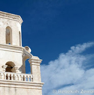
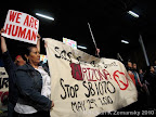
Things here in Phoenix have been heating up lately, and not just because it’s May and the temperatures are steadily, inevitably climbing towards the 100’s. There’s this little thing called SB-1070 that has been in the news recently, and now this is the hotspot for politics as well as border crossing traffic. It’s the perfect summer to be in the newsroom looking at border issues – and having a bit of a travel budget is the icing on the cake.

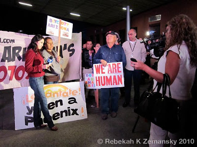
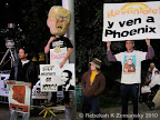
Let’s take a quick rundown of last week, for example. On Monday, we rose early to be downtown in Phoenix by 4am to see Telemundo broadcast a live immigration special and the audience’s reaction. (they covered the issue in-depth again two days later)

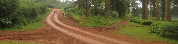
Next, my teammates and I made a run to Tucson, Arizona to interview several contacts there and sit in on Operation Streamline hearings. Operation Streamline started in Del Rio, Texas, but is now operational all along the border and making news and encouraging debate again along with SB-1070.

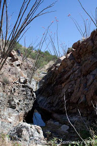
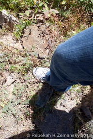
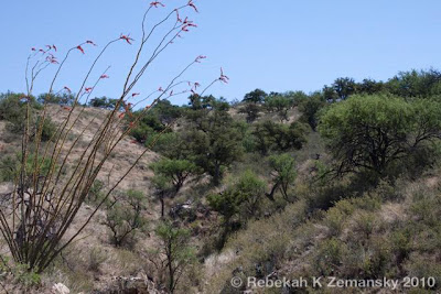
Finally, while my team headed back to cover Saturday’s protest events, I spent one more day in Tucson to ride along on a Samaritan patrol. My classmates and I have been in talks to do a Border Patrol ride along too, as both are great ways to get out and see the landscape and understand what people are literally going through.

Tags: , , , , , , , , , ,

Here’s the second half – or top three layers – of my border mapping project :

Border Relations

Consulates, humanitarian groups, and medical facilities that play a role in policy along the border.

key:
red = medical facility
green = humanitarian organizations
pink = El Salvadoran or Guatemalan consulate
lavendar = Mexican consulate
turquoise = US consulate

Border Patrol

US Border Patrol stations along the US-Mexico Border, with each station’s sector assignment in the key.

Border Lands

A breakdown of border boundaries, plus cities and facilities that play a role in Arizona or Tucson Sector policy.

key:
red = medical facility
green = humanitarian organizations
pink = El Salvadoran or Guatemalan consulate
lavendar = Mexican consulat
turquoise = US consulate
yellow = US Border Patrol Station

sources : http://www.cbp.gov/xp/cgov/border_security/border_patrol/border_patrol_sectors/, http://www.usembassy-mexico.gov/eng/edirectory.html, http://www.mexonline.com/consulate.html, http://www.consulateofguatemalaindenver.org/cons_eng.asp, http://www.elsalvador.org/embajadas/eeuu/home.nsf/0/12f9de74529dada785256b0a005ba4c8?OpenDocument

Tags: , , , , , , , , , , , , , , , , , , , , , , , , , , , ,

I’m working on a big project for one of my classes – one that’s been growing and growing and growing to the point where it’s spilled over into two other classes! The project involves many locations along the US-Mexico border and will have a number of media components to show different parts of the story and the data. There’s going to be a major mapping component, and I’ve started posting some of the locations with Google Maps since they can be embedded into the final website for one of the classes.

Google Maps does not have a layering feature, so I’m experimenting with simulating a layering effect through creating multiple maps. Each will have a different component of the story – cities, boundaries, etc. – and will go on the same section of the final webpage. The last map includes all layers from the previous maps. Here are the first two – let me know what you think, and if you have suggestions for what I should include, leave me a comment telling what and why!

Border Boundaries

American and Mexican states along the US-Mexico border.

Border Cities

Cities that play an important role in border policy and migrant travel routes.

Tags: , , , , , , , , , , , , , , , , , , , , , , , , , , ,

An interesting lesson today about finding good English language news sources for Mexico… Anyway, here is what I scrambled…

Mexico

Mexico

Alternatives to drug war championed at conference (Sept 28)
$22 million loan will help with Tijuana water and sewage (Sept 29)
Immigrant deaths near US-Mexico border in 2009 expected to surpass previous year’s total (Oct 2)
Immigrant deaths near the US-Mexico border at a glance (Oct 2)
Mexican Consulate marks Binational Health Week (Oct 2)
City, Baja California officials working on tourist-friendly police force (Oct 6)

This site requires registration for a free 1 day pass, so I’m including a teaser…
History via cell phone (Oct 2) President Felipe Calderon last weekend announced the start of the project “Mexico is my museum,” designed to bring the history of the Revolution and Independence in touching distance of the 76 million Mexicans that own cellphones.

The Disturnell map of 1847

The Disturnell map of 1847

For more background (& more maps):
Perry-Castañeda Library
Map Collection – Atlas of Mexico

Why all the Mexico posts? ‘Cause I’m headed their for my first visit one week from today… Yes, I plan to post pictures…

Tags: , , , , , , ,

Follow

Get every new post delivered to your Inbox

Join other followers:

%d bloggers like this: