maps

You are currently browsing articles tagged maps.

Here’s the second half – or top three layers – of my border mapping project :

Border Relations

Consulates, humanitarian groups, and medical facilities that play a role in policy along the border.

key:
red = medical facility
green = humanitarian organizations
pink = El Salvadoran or Guatemalan consulate
lavendar = Mexican consulate
turquoise = US consulate

Border Patrol

US Border Patrol stations along the US-Mexico Border, with each station’s sector assignment in the key.

Border Lands

A breakdown of border boundaries, plus cities and facilities that play a role in Arizona or Tucson Sector policy.

key:
red = medical facility
green = humanitarian organizations
pink = El Salvadoran or Guatemalan consulate
lavendar = Mexican consulat
turquoise = US consulate
yellow = US Border Patrol Station

sources : http://www.cbp.gov/xp/cgov/border_security/border_patrol/border_patrol_sectors/, http://www.usembassy-mexico.gov/eng/edirectory.html, http://www.mexonline.com/consulate.html, http://www.consulateofguatemalaindenver.org/cons_eng.asp, http://www.elsalvador.org/embajadas/eeuu/home.nsf/0/12f9de74529dada785256b0a005ba4c8?OpenDocument

Tags: , , , , , , , , , , , , , , , , , , , , , , , , , , , ,

I’m working on a big project for one of my classes – one that’s been growing and growing and growing to the point where it’s spilled over into two other classes! The project involves many locations along the US-Mexico border and will have a number of media components to show different parts of the story and the data. There’s going to be a major mapping component, and I’ve started posting some of the locations with Google Maps since they can be embedded into the final website for one of the classes.

Google Maps does not have a layering feature, so I’m experimenting with simulating a layering effect through creating multiple maps. Each will have a different component of the story – cities, boundaries, etc. – and will go on the same section of the final webpage. The last map includes all layers from the previous maps. Here are the first two – let me know what you think, and if you have suggestions for what I should include, leave me a comment telling what and why!

Border Boundaries

American and Mexican states along the US-Mexico border.

Border Cities

Cities that play an important role in border policy and migrant travel routes.

Tags: , , , , , , , , , , , , , , , , , , , , , , , , , , ,

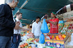
First things first, credit for these photos go to my friends Gabrielle Vincent and Preeti Singh (except for the fruit which is courtesy of Wikipedia.org).

This summer I found out that a friend of mine has started working with a Haitian development organization called Sonje Ayiti. Sonje Ayiti (based out of Limonade) is unique because it’s a grassroots group of Haitians living both in Haiti and the US, as opposed to a larger, international organization like the Red Cross or Doctors Without Borders – all great groups, with different goals and methods but a similar overall purpose of improving the lives of people wherever they work.

In Sonje Ayiti’s case, they’ve been operating long enough that their goals are starting to get bigger, and they’re going through one of those painful but rewarding growth stages where they have to figure out what they want to do and how to do it. They have projects ranging from livestock distribution to sewing training. Their goals are to connect grant funding with local contacts to kick start local businesses, get kids into schools, and most importantly, empower Haitians with some of the same opportunities the rest of us enjoy to take control of our finances and our lives.

One of the big obstacles – a dramatic lack of infrastructure and a culture of corruption that’s deeply embedded in the country’s politics (see this example of BBC’s coverage).

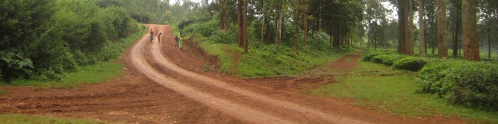
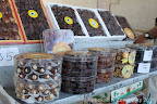
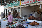
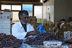
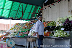
On the other hand, it’s a land rich in agricultural resources – mangoes, avocados, peanuts, cocoa beans – and more importantly, strong people. The more I learned, the more I look forward to visiting some day.

Like everyone else, when I heard about the earthquake, I was overwhelmed. I hoped that the people I know – or at least, the people that people I know know – are safe, yet as I hear about the casualties, I know that not everyone will be ok. The toll includes international aid workers – the very people needed by international organizations to coordinate relief efforts – as well as Haitians. Gradually, I started to get news – Sonje Ayiti’s main point person in Port au Prince, Gabie, was safe and starting to locate family members. A partial sigh of relief.

But I knew that as bad as the initial situation was, it would get even worse, and quickly. All those obstacles to development projects? Twice as difficult now, when emergency services are so important. There’s a great post here, at the blog Wanderlust, about the obstacles medical and aid workers will be facing as they try to help. Some sources like the author of this Economist article are even asking if this is “the end.”

And then I was shocked and disappointed as a bizarre backlash started – certain networks and commentators labeling a whole population with negative terms or characteristics. Simultaneously, this is deeply offensive and untrue and exposes deep ignorance of people who don’t travel physically or, more importantly, mentally. It’s harmful and inexcusable.

I’m not linking to it because it’s not productive (and all too easy to find). Instead, at about 4:08 minutes in, here’s Jon Stewart’s awesome response.

What Haiti needs now is what any country or people need in an emergency – water, food, shelter, medical aid. As I mentioned earlier, Doctors Without Borders and Red Cross are stellar organizations.

In the long term, Haiti needs infrastructure, which may not be possible without addressing the systematic corruption that’s damaged efforts again and again. That’s where groups like Sonje Ayiti may come into play. And perhaps most importantly – we all need to learn more about what’s going on and how we can work together. Academic coverage, news coverage, personal connections, and blogs are all a good start.

Here’s a list of links that I’ve found useful:

Crises Map
Relief Web
Dispatches From a Fragile Island – a really fascinating blog
Partners in Health section on Haiti – according to the person who sent me this link, “They are actually doing one of the best jobs right now because their own rural centers were not as affected and their organization is based there and up and running.”
New York Times interactive coverage

The University of Texas at Austin’s Perry-Castañeda Library Map Collection currently has maps of Haiti, Haitian cities, the earthquake, the response, and other national features on their main page

Please post your thoughts about Haiti, and if you have other good sources, share, or you’ve ever been, tell me what your trip was like

Tags: , , , , , , , , , , , , , , , , , ,

On the sixth day of the trip, we went to Abu Dhabi (check out Lonely Planet’s interactive map here) and started with the marketplaces. Here’s another post from our trip blog. I’m also continuing to update my trip photos map – a never ending process at this rate! I have a lot more to post, and what I don’t get up before our Monday evening departure I’ll post from home base.

So, without further ado, Abu Dhabi markets:

Dates

I think few things taste as good as a chocolate covered date.

Fruits & Vegetables

The fruit and vegetables in these stands were so many beautiful colors.

Fish

This is a place of truly… amazing… smells – for people with strong stomachs only!

For the rest of the Abu Dhabi pictures, click below…

Abu Dhabi (January 2010)

Tags: , , , , , , , , , , ,

China

China

China had been the People’s Republic of China for 60 years now since the Communist Party came to power, and they celebrated October 1 with massive parades and displays.

The parades and events are amazing, and this video is stunningly shot, a great example of multimedia event coverage: Timelapse of in Tiananmen Square. This video of a re-enactment is from the same photographer – Re-enacting the making of Mao’s China – and here is background information on the techniques used – Here.

Photo links: Slideshow from Life
Links to coverage at The Gaurdian, ABC News, and Reuters:

The Gaurdian 60th Anniversary parade Reuters Aerial

Coverage from China Post (self-described as Taiwan’s leading English-language newspaper in daily readership and editorial content): China’s 60th anniversary stirs pride, also unease

BBC Coverage:
Communist China marks 60th year
North Korea’s Kim Jong-il and Chinese Premier Wen Jiabao watch the parades: Celebrations Mark China Visit
Art & Politics in China: Audio Slideshow
Great facts and statistics on Chinese demography including categories on population, wealth, military, and food: China: 60 years in facts and figures
Looking forward: a great survey page of individual Chinese and their thoughts on the future – Where will China be in 60 years?

For an introduction to the changes going on in China’s economy, I recommend Ted Koppel’s Discovery documentary (behind-the-scenes slideshow here and LA Times coverage of the series here).

Communist China Map Folio (1967)

Communist China Map Folio (1967)


Mongol Dominions, 1300-1405

Mongol Dominions, 1300-1405

Tags: , , , , , , , ,

Uganda

Uganda

I realized almost the moment I started this post that I could get in over my head pretty quickly. There is so much going on and so much needing coverage. So I’m going to keep this post pretty narrow, but I can assure you there will be future posts on issues in this region. If I leave stuff out, if you have questions about anything I’m not explaining well or leaving out, please, please talk to me know in the comments section – I’ll look up what I don’t know and go from there. OK. Diving in.

The Lord’s Resistance Army, or LRA, is a rebel movement known for using brutal tactics and child soldiers during a long running conflict in Uganda. – Behind the LRA’s terror tactics

Children in Uganda are especially vulnerable, and often become “night commuters” to seek safety. – & Gulu Walk & Invisible Children

But as the conflict in Uganda ebbs and flows, the LRA often crosses the border into neighboring countries including DR Congo and Central African Republic, and bring their brutality with them. This month, disturbing new reports of LRA violence in CAR. – Rebel terror spreads to CAR

Violence in DR Congo has also been severe, as cited in these BBC reports from last year (which coincided with General Laurent Nkunda’s offensive near Goma, further south).
Congo terror after LRA rebel raids
BBC Slideshow on Congolese refugees

My awareness of the situation really deepened thanks to a classmate whose blog, Jackfruity, I just got added to my blog roll.

Ways to help kids in Uganda: The Invisible Children Campaign

And for kids in the United States: INVISIBLE CHILDREN: Kids at Risk Action (KARA) – Children’s Rights Advocacy Network

Next post: barring breaking news, will be a bit lighter after natural disasters and regional conflicts. But thanks for sticking with me so far. I like to think it’ll be worth it. Below, Uganda is in red, just to the east of DR Congo.

Central African Republic (CAR)

Central African Republic (CAR)

Tags: , , , , , , , ,

An interesting lesson today about finding good English language news sources for Mexico… Anyway, here is what I scrambled…

Mexico

Mexico

Alternatives to drug war championed at conference (Sept 28)
$22 million loan will help with Tijuana water and sewage (Sept 29)
Immigrant deaths near US-Mexico border in 2009 expected to surpass previous year’s total (Oct 2)
Immigrant deaths near the US-Mexico border at a glance (Oct 2)
Mexican Consulate marks Binational Health Week (Oct 2)
City, Baja California officials working on tourist-friendly police force (Oct 6)

This site requires registration for a free 1 day pass, so I’m including a teaser…
History via cell phone (Oct 2) President Felipe Calderon last weekend announced the start of the project “Mexico is my museum,” designed to bring the history of the Revolution and Independence in touching distance of the 76 million Mexicans that own cellphones.

The Disturnell map of 1847

The Disturnell map of 1847

For more background (& more maps):
Perry-Castañeda Library
Map Collection – Atlas of Mexico

Why all the Mexico posts? ‘Cause I’m headed their for my first visit one week from today… Yes, I plan to post pictures…

Tags: , , , , , , ,

Kaitaia

Kaitaia

So wanderlust and itchy feet may not be the only thing I’ve inherited from my family.

Over the weekend, my parents flew from Taupo to Kaitaia – my dad took his friend’s plane up, and then took a Cessna 172 back, at times flying next to the Tecnam Sierra now flown by his friend.  This evening, my mother sent me these pictures, taken September 19-21.  I’ve been teased before about some of the things that always turn up in my photos, but looking at my mother’s, there’s definitely some similar subject matter.

There’s “process pictures” – in this case, pictures of gum collection, which I’m promised more information on later.

There’s “setting pictures” that try to describe the differences between spaces or things which exist everywhere – like houses, rooms, transportation, and restaurants – but vary from place to place.

There are pictures of other pictures, and pictures of things that catch our eye because of a name or number or pattern.

And finally, there are pictures taken out of the window – in this case, out the window of each plane on the way there on the way back.  In the last set, there are good shots of the Tecnam Sierra they flew on the way out.

This week, I’ll post examples of each from my pictures.

Tags: , , , , , , ,

Follow

Get every new post delivered to your Inbox

Join other followers:

%d bloggers like this: